I am currently an AI researcher at HD KSOE*, South Korea.
I received my master’s degree in 3D Vision & Robotics Lab at UNIST, advised by prof. Kyungdon Joo.
*HD KSOE (HD KOREA SHIPBUILDING & OFFSHORE ENGINEERING CO., LTD)
I am interested in 3D vision, Computer vision, and Robotics.
In particular, I am currently focusing on the AI perception tasks for robot navigation and autonomous driving, such as depth estimation.
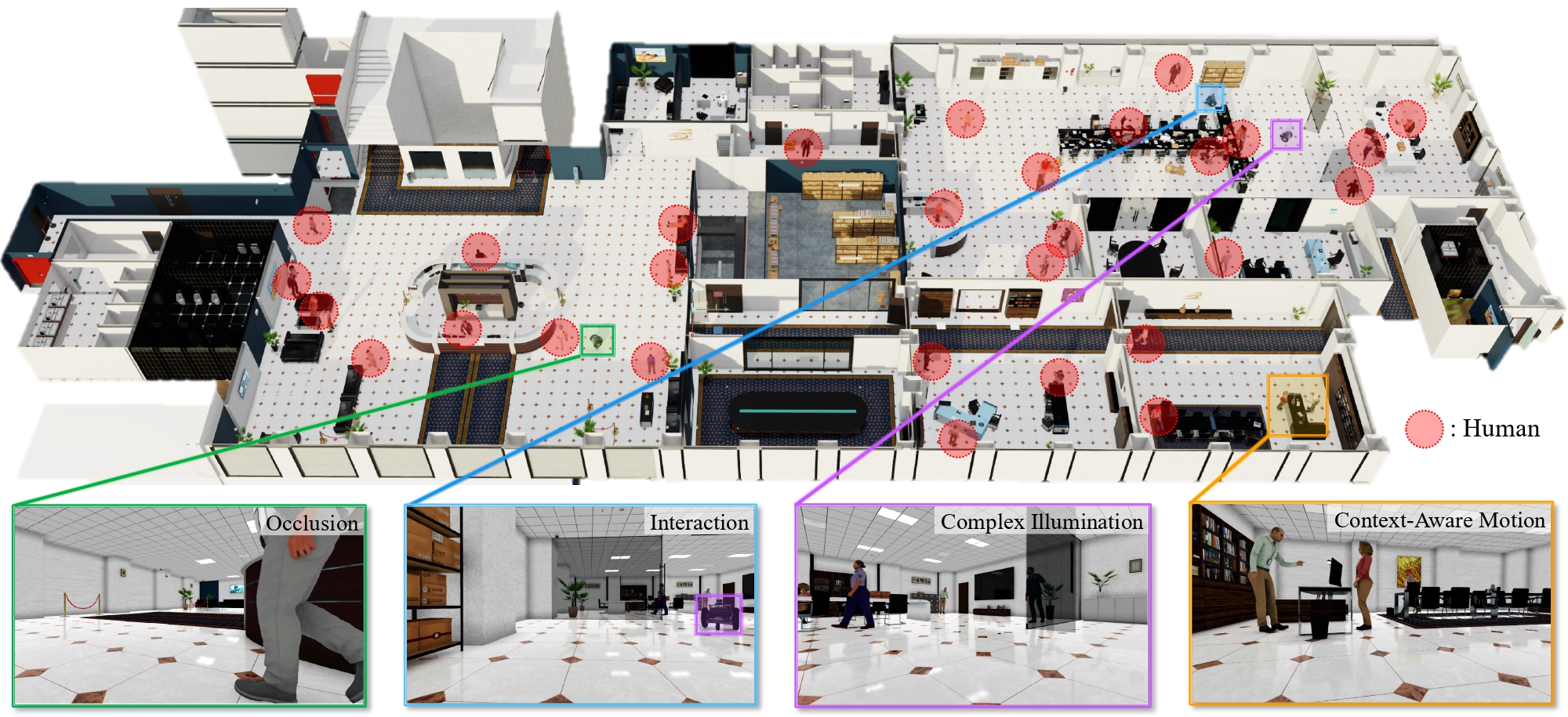
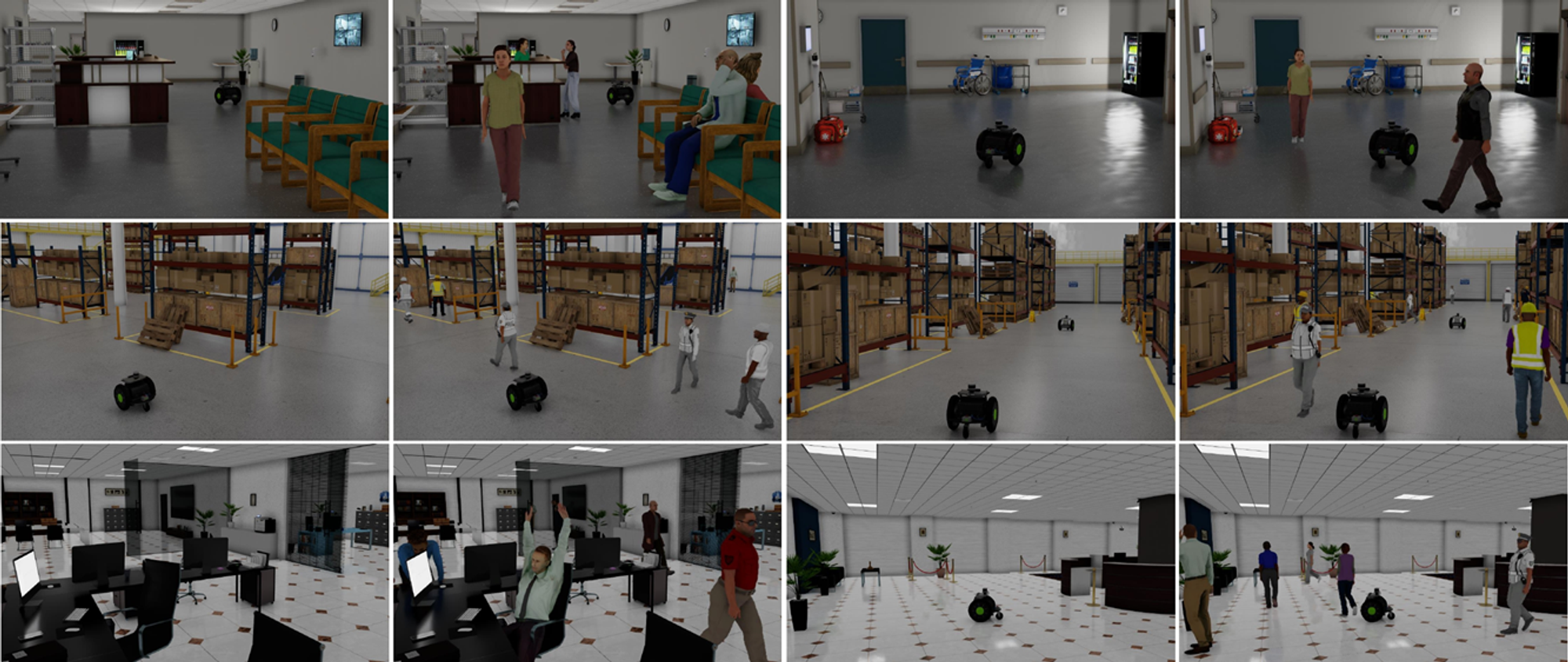
A Benchmark Dataset for Collaborative SLAM in Service Environments Harin Park,
Inha Lee,
Minje Kim,
Hyungyu Park,
Kyungdon Joo RA-L, 2024
[
Project page
|
Paper
]
Propose a benchmark synthetic dataset for C-SLAM for multiple service robots.
Presented in Synthetic Data for Computer Vision Workshop at CVPR 2024
(Long paper honorable mention Award).
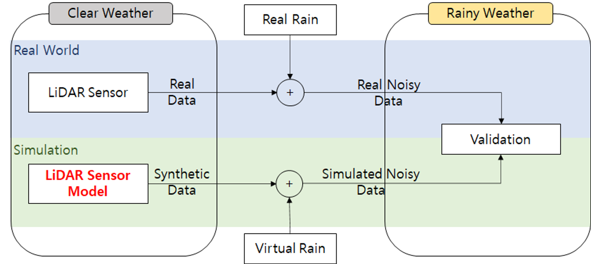
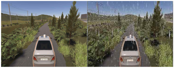
Modeling and Simulation of Rainfall Effect of Autonomous Driving LiDAR Sensor. Taeyeon Park,
Jangwoo Cheon,
Impyeong Lee
GISUP, 2021
Propose the LiDAR radiometric model reflecting the effects that real rain influence to LiDAR sensor.
Evaluate the model accuracy through the comparison with real-world LiDAR data.
Simulation of LiDAR Sensor considering Rainfall Effect (강우 효과를 고려한 라이다 센서 시뮬레이션) Taeyeon Park,
Gyuseok Lee,
Jangwoo Cheon,
Impyeong Lee
KICS, 2021
[
Paper
]
Propose the LiDAR radiometric model reflecting the effects that real rain influence to LiDAR sensor.
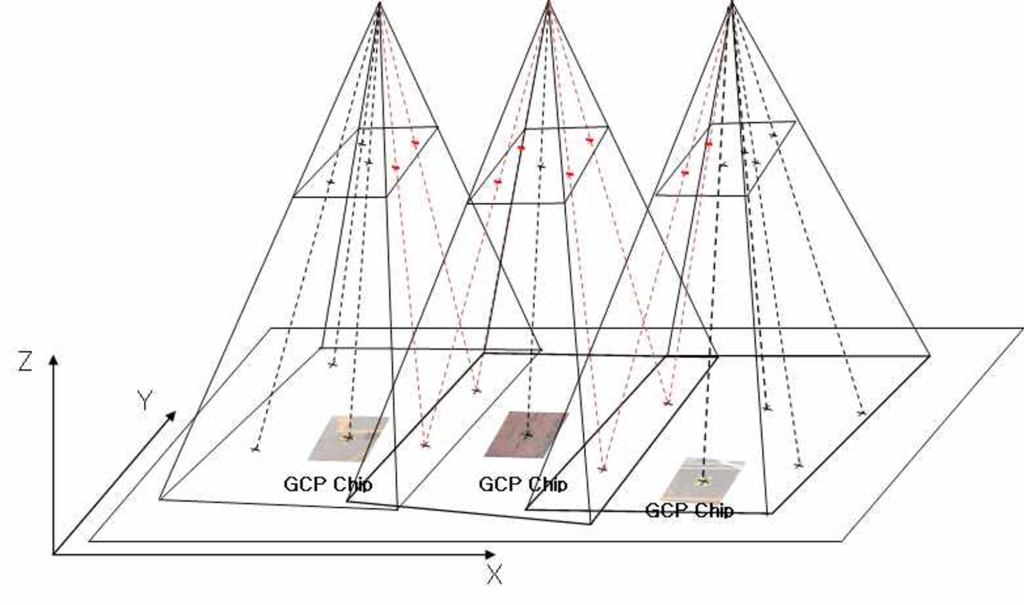
Evaluation for the validity of introducing GCP Chips in Aerial Triangulation.
Jangwoo Cheon,
Taeyeon Park,
Impyeong Lee
ISRS, 2021
Utilize the GCP Chips for the automation of aerial triangulation.
Develop the automation technology through image matching between aerial images and GCP Chips.
Projects
Depth estimation based on omnidirectional cameras On-going project, (2023.9 ~ Present)
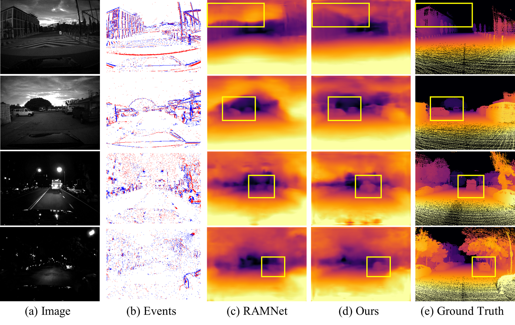
Propose a structure-aware monocular depth estimation via omnidirectional images.
Propose a monocualr depth estimation model via the fusion of events and images.
Utilize the event refinement module to remove noises and enhance the real events.
Adapt the local distribution learning method to work well in outdoor environments with a wide depth range and consider the local details of the events.
Collaborative SLAM (C-SLAM) benchmark dataset Funded by the IITP, (2022.9 ~ 2024.12)
Propose the benchmark synthetic C-SLAM dataset for multiple service robots.
Includes the various challenging cases where SLAM algorithms are difficult to work with.
Provide the static/dynamic sequences for efficient evaluation of algorithms handling dynamic objects.
Automation of Aerial Triangulation using ground control point (GCP) chips.
(2021.5 ~ 2021.5)
Utilize the GCP Chips for the automation of aerial triangulation.
Develop automation technology through image matching between aerial images and GCP chips.
Simulation of LiDAR Sensor considering rainfall effect
(2021.3 ~ 2022.2)
Propose the LiDAR radiometric model reflecting the effects that real rain influence to LiDAR sensor.
Evaluate the model accuracy through the comparison with real-world LiDAR data.
Awards & Honors
Long paper honorable mention award (Synthetic data for computer vision workshop in CVPR 2024)
Teaching
Introduction to robotics course, UNIST (2023.9 ~ 2023.12)
Photogrammetry course, University of Seoul (2021.9 ~ 2021.12)
Education
M.S in Artificial Intelligence Graduate School, UNIST (2022.09 ~ 2024.09)
Bachelor in Geospatial Information, Pukyung National University (2017.03. ~ 2021.02)